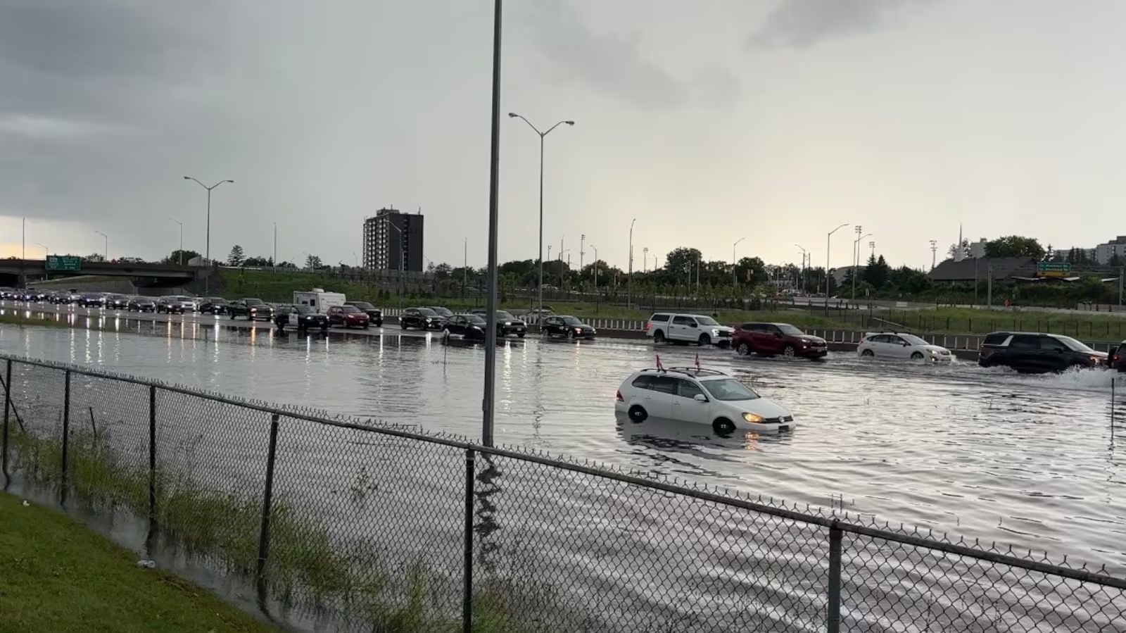
Severe thunderstorms triggered significant flooding in Aurora, Illinois, overnight, prompting widespread road closures, flash flood warnings, and travel disruptions across the city and surrounding communities. Emergency officials are urging residents to avoid flooded roadways after torrential rainfall overwhelmed drainage systems and left numerous streets impassable.
According to the National Weather Service, a Flood Warning remains in effect for Aurora and portions of Kane, DuPage, Kendall, and Will counties after excessive rainfall produced widespread urban flooding. Officials reported that some locations received up to 6 inches of rain, resulting in extensive street flooding, overflowing creeks, and water entering basements in some neighborhoods. Floodwaters are expected to recede slowly, even after the heaviest rainfall has ended.
Several roads throughout the Aurora area have been temporarily closed because of dangerous flood conditions. Reports indicate that Illinois Route 56 experienced flooding in multiple locations, while additional low-lying roads and intersections became impassable as stormwater accumulated. Emergency management officials have advised motorists never to drive through standing water, reminding the public that floodwaters can conceal washed-out pavement and other hidden hazards.
Local law enforcement, emergency dispatch centers, and highway departments have spent the night responding to numerous flooding incidents across the region. Crews continue monitoring rivers, streams, and drainage systems while clearing debris and reopening roads as water levels begin to fall. Authorities emphasize that some flooded areas may remain hazardous for several hours because runoff continues flowing into creeks and rivers.
The flooding extends beyond Aurora, affecting neighboring communities including Naperville, Bolingbrook, Plainfield, Oswego, Romeoville, Batavia, West Chicago, and other parts of northeastern Illinois. Officials say urban flooding has been especially severe in areas with poor drainage, where streets, parking lots, and underpasses quickly filled with water during the overnight storms.
Residents are encouraged to remain alert as additional showers remain possible. Although the most intense rainfall has moved out of the area, saturated ground and elevated water levels could prolong flooding throughout the day. Emergency officials recommend avoiding unnecessary travel, monitoring weather alerts, and reporting flooded roadways or storm-related hazards to local authorities.
The National Weather Service continues reminding residents to follow the safety message, “Turn Around, Don’t Drown,” noting that the majority of flood-related fatalities occur when motorists attempt to drive through flooded roads. Even relatively shallow water can carry away a vehicle or hide dangerous washouts beneath the surface.
Cleanup operations are expected to continue throughout the day as city crews assess storm damage and restore normal traffic conditions. Residents should continue monitoring official updates from the National Weather Service and local emergency management agencies until flood warnings expire and road conditions improve.